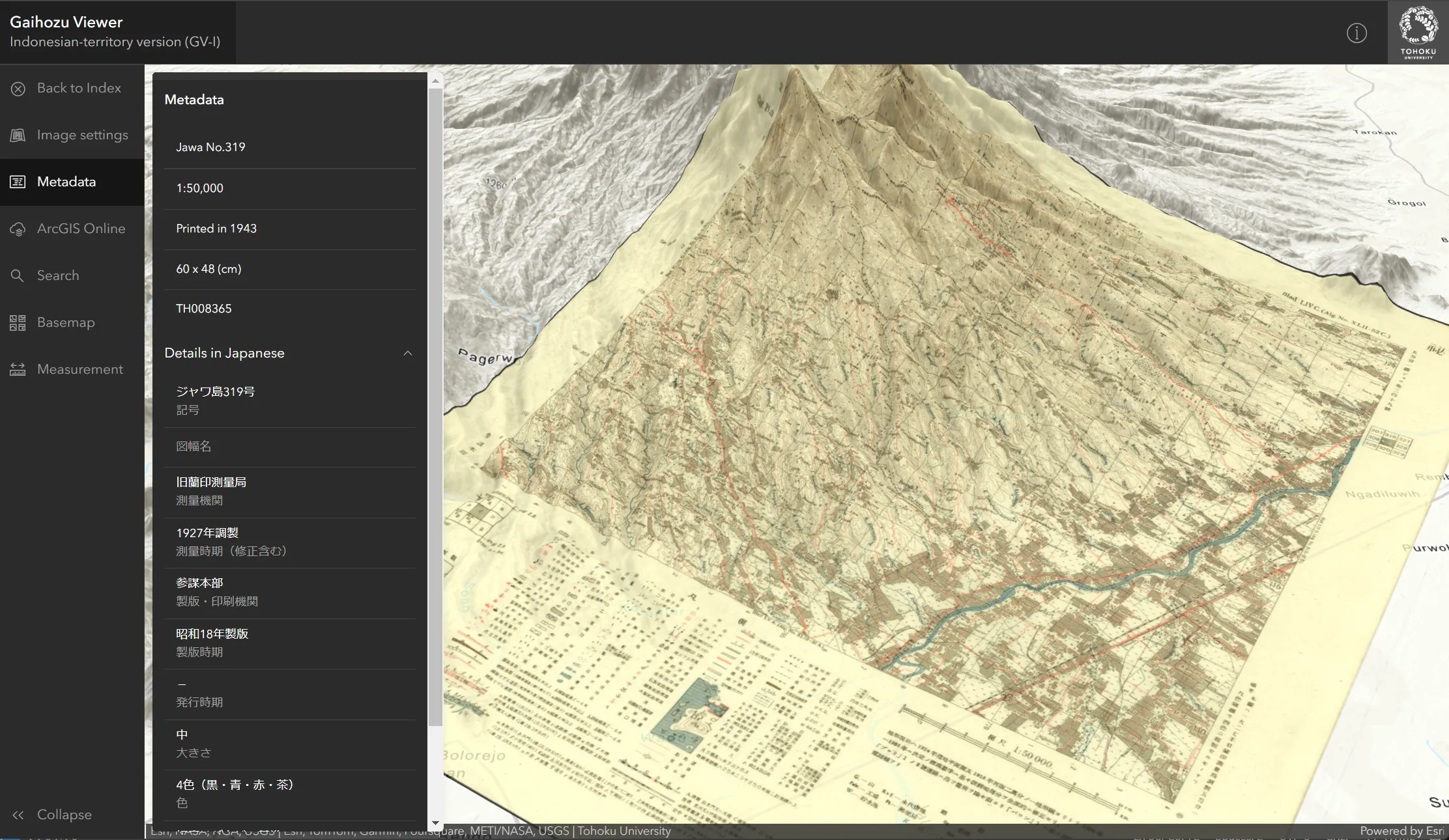
Gaihozu meaning “maps of outer lands” is the maps of areas outside the Japanese Islands made by former Japanese Imperial Army before the end of the World War II. Despite the fact that these maps were prepared for military purpose, they contain the valuable records of detailed landscapes including landuse and landcover in the past. This site was designed with ArcGIS Online technology to interactively view about 680 geo-referenced maps in Indonesian territory from the collection of Gaihozu at Tohoku University.
Clicking a shaded box on the index map enable you to show the corresponding geo-referenced map in 3D scene with its metadata, such as map scale and printed year. Clicking a button of ratio like 1:500,000 switched the index map of the corresponding map scale.
If you need further information on Gaihozu, visit the Gaihozu Digital Archive maintained by the Tohoku University Library and the Institute of Geography, Graduate School of Science, Tohoku University. The article about this web application is published on ArcUser.
Copyright (C) 2020- Human Geography Research Group at Tohoku University (Environmental Geography Lab at the Graduate School of Environmental Studies and the Institute of Geography, the Graduate School of Science, Tohoku University)
Project team members: T. Nakaya, S. Nagata, Y. Isoda and R. Sekine (Tohoku University) + Y. Hoshida (OpenConcierge)
Don't show this message again.
Close
Gaihozu meaning “maps of outer lands” is the maps of areas outside the Japanese Islands made by former Japanese Imperial Army before the end of the World War II. Despite the fact that these maps were prepared for military purpose, they contain the valuable records of detailed landscapes including landuse and landcover in the past. This site was designed with ArcGIS Online technology to interactively view about 680 geo-referenced maps in Indonesian territory from the collection of Gaihozu at Tohoku University.
Clicking a shaded box on the index map enable you to show the corresponding geo-referenced map in 3D scene with its metadata, such as map scale and printed year. Clicking a button of ratio like 1:500,000 switched the index map of the corresponding map scale.
If you need further information on Gaihozu, visit the Gaihozu Digital Archive maintained by the Tohoku University Library and the Institute of Geography, Graduate School of Science, Tohoku University. The article about this web application is published on ArcUser.
Special thanks to Dr. Fatwa Ramdani (Brawijaya University, Indonesia) for his valuable comments to the earlier version of this project site and Mr. Kohsuke Hada for his help on the identification of old map datum. This project was financially supported by JSPS KAKENHI 16H01965 (PI: Prof Keiji Yano).
Copyright (C) 2020- Human Geography Research Group at Tohoku University (Environmental Geography Lab at the Graduate School of Environmental Studies and the Institute of Geography, the Graduate School of Science, Tohoku University)
Project team members: T. Nakaya, S. Nagata, Y. Isoda and R. Sekine (Tohoku University) + Y. Hoshida (OpenConcierge)
Close